Data Selection MapContact Us
Support
Verified address and coordinate-level nationwide Data intelligence.
Identifies all location structures where broadband service is or can be installed, including federally defined Broadband Serviceable Locations.
*Source: CostQuest Custom Model
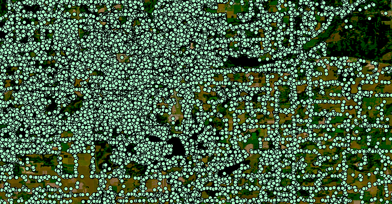
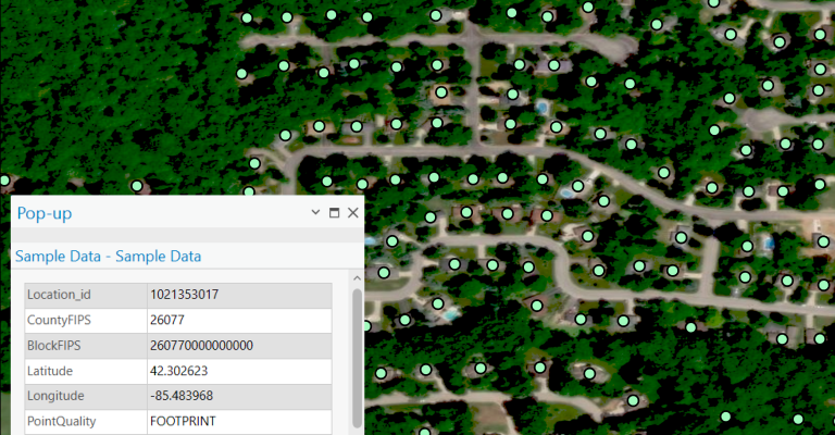
The Broadband Fabric Location Data Suite is a nationwide coordinate and address-level GIS Dataset designed for precision in broadband planning, infrastructure deployment, and policy analysis. It includes over 115 million Broadband Serviceable Locations (BSLs), including residential, business, multi-dwelling units, community anchor institutions (CAIs), and agricultural lands.
Each location is assigned a universal unique ID, ensuring seamless integration with additional Datasets. The schema aligns with the National Broadband Serviceable Location Fabric, supporting the FCC’s Broadband Data Collection (BDC), National Broadband Map, NTIA’s BEAD, and other federal broadband funding initiatives.
This Dataset is optimized for use in GIS platforms, network planning software, SQL databases, and analytical tools, offering the foundational intelligence required to efficiently inform broadband infrastructure strategies and operations with confidence.

Identifies all location structures where broadband service is or can be installed, including federally defined Broadband Serviceable Locations.
*Source: CostQuest Custom Model