Data Selection MapContact Us
Support
Broadband service coverage, provider footprints, and federal funding details.
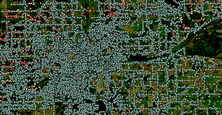
Identifies all location structures where broadband service is or can be installed, including federally defined Broadband Serviceable Locations.
*Source: CostQuest Custom Model
Tracks broadband availability, provider coverage, technology, and service levels at each Broadband Serviceable Location.
*Source: FCC National Broadband Map
Identifies Broadband Serviceable Locations that have received federal broadband funding.
*Source: FCC Broadband Funding Map
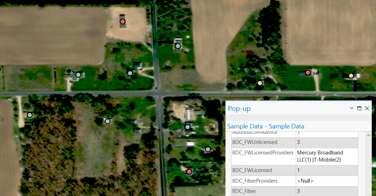
Indicates whether a location that falls under an existing federal funding program is covered or uncovered with funding, and with residential or business services using licensed fixed wireless or wired technologies (i.e., Copper, Cable, Fiber to the Premises, Licensed Fixed Wireless, or Licensed-by-Rule Fixed Wireless) with speeds of at least 25/3 Mbps or 100/20 Mbps.
*Sourced from the FCC Broadband Funding Map
The Broadband Fabric ServiceLandscape Data Suite delivers a comprehensive view of broadband availability, competition, and federal funding at a granular level. Built on CostQuest’s Location Data, this Dataset includes precise geospatial service availability insights sourced from the FCC’s Broadband Data Collection (BDC) program, the industry-standard Dataset used by governments and organizations.
Each location entry includes verified service availability by provider and technology type, competitive landscape insights for assessing broadband market density, and federal funding allocations that highlight existing infrastructure investments and their impact on connectivity.
Designed for broadband policy evaluation, competitive analysis, and market intelligence, the Service Landscape Data Suite supports accurate infrastructure assessments and investments across all U.S. counties, states, and territories.

Identifies all location structures where broadband service is or can be installed, including federally defined Broadband Serviceable Locations.
*Source: CostQuest Custom Model
Tracks broadband availability, provider coverage, technology, and service levels at each Broadband Serviceable Location.
*Source: FCC National Broadband Map
Identifies Broadband Serviceable Locations that have received federal broadband funding.
*Source: FCC Broadband Funding Map
Indicates whether a location that falls under an existing federal funding program is covered or uncovered with funding, and with residential or business services using licensed fixed wireless or wired technologies (i.e., Copper, Cable, Fiber to the Premises, Licensed Fixed Wireless, or Licensed-by-Rule Fixed Wireless) with speeds of at least 25/3 Mbps or 100/20 Mbps.
*Sourced from the FCC Broadband Funding Map